Geospatial Technology – An Approach to invest in our Planet (Earth Day Special) Geospatial Technology, which is also called Remote Sensing and GIS Technology byadminApril 24, 2023
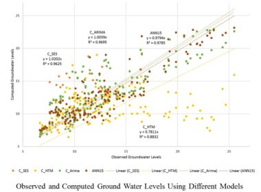
Geospatial Techniques for Prediction of Ground Water Level Ground Water Level Prediction using Geospatial Technology and Mathematical byadminMay 17, 2022
GIS Used for Rainfall Data Analysis Rainfall data Analysis Using ARC/GIS GIS software can be used to generate byadminMay 4, 2022
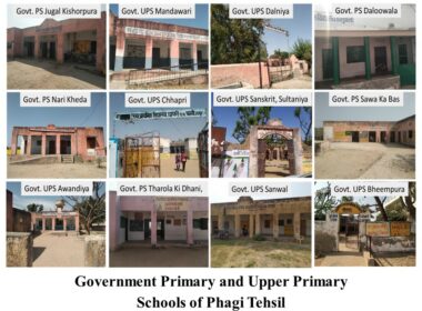
GIS for Location Data Generation Location of Government Schools in Phagi Tehsil Locations database mapping play byadminApril 30, 2022